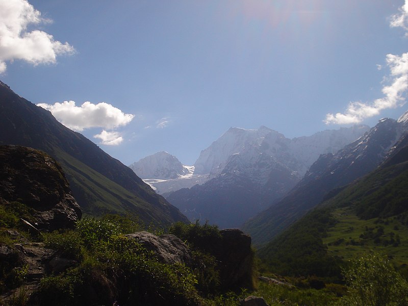
Valley of Flowers National Park is an Indian national park, Nestled high in West Himalaya, is renowned for its meadows of endemic alpine flowers and outstanding natural beauty. It is located in Uttarakhand state. This richly diverse area is also home to rare and endangered animals, including the Asiatic black bear, snow leopard, brown bear and blue sheep. The gentle landscape of the Valley of Flowers National Park complements the rugged mountain wilderness of Nanda Devi National Park. Together they encompass a unique transition zone between the mountain ranges of the Zanskar and Great Himalaya. The park stretches over an expanse of 87.50 km².
 The Valley of Flowers is an outstandingly beautiful high-altitude Himalayan valley that has been acknowledged as such by renowned mountaineers and botanists in literature for over a century and in Hindu mythology for much longer. Its ‘gentle’ landscape, breathtakingly beautiful meadows of alpine flowers and ease of access complement the rugged, mountain wilderness for which the inner basin of Nanda Devi National Park is renowned.
Valley of flower is splashed with colour as it bloomed with hundreds different beautiful flowers, taking on various shades of colours as time progressed. Valley was declared a national park in 1982, and now it is a World Heritage Site. The locals, of course, always knew of the existence of the valley, and believed that it was inhabited by fairies.
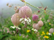
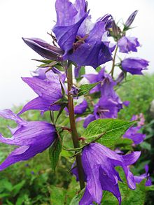
The valley is home to many celebrated flowers like the Brahmakamal, the Blue Poppy and the Cobra Lily. It is a much sought after haunt for flower-lovers, botanists and of course trekkers, for whom a sufficient excuse to embark on a mission to reach a place, is that it exists.
 The Valley of Flowers is internationally important on account of its diverse alpine flora, representative of the Western Himalayan alpine shrub and meadows ecoregion. The rich diversity of species reflects the valley’s location within a transition zone between the Zaskar and Great Himalayas ranges to the north and south, respectively, and between the Eastern Himalaya and Western Himalaya flora. A number of plant species are internationally threatened, several have not been recorded from elsewhere in Uttarakhand and two have not been recorded in Nanda Devi National Park. The diversity of threatened species of medicinal plants is higher than has been recorded in other Indian Himalayan protected areas. The entire Nanda Devi Biosphere Reserve lies within the Western Himalayas Endemic Bird Area (EBA). Seven restricted-range bird species are endemic to this part of the EBA.
The Valley of Flowers was declared a national park in 1982. This part of Uttarakhand, in the upper reaches of Garhwal, is inaccessible through much of the year. The area lies on the Zanskar range of the Himalayas with the highest point in the national park being Gauri Parbat at 6,719 m above sea level.
History
According to the Ramayan this is the place where Hanuman searched for Sanjivani Booti to cure Lakshman when he was injured by Indrajit(Meghnada), the son of Ravana.

The place had disappeared from the tourist map due to its inaccessible approach but in 1931 Frank S. Smythe a British mountaineer lost his way while returning from a successful expedition to Mt.Kamet and happened upon this valley which was full of flowers. He was so attracted towards the beauty of the place he named it the "Valley of Flowers". He authored a book called "The Valley of Flowers" which unveiled the beauty and floral splendours of the valley and thus threw open the doors of this verdant jewel to nature-enthusiasts all over the world.
In 1939 Miss Margaret Legge, a botanist deputed by the Royal Botanic Gardens Edinburgh arrived at the valley for further studies. While she was traversing some rocky slopes to collect flowers, she slipped off and was lost forever. Her sister later visited the valley and erected a memorial near the spot. The memorial is still there.
 Prof. Chandra Prakash Kala, a botanist deputed by the Wildlife Institute of India, carried out a remarkable research study on the floristics and conservation of the valley for a decade starting in 1993. He made an inventory of 520 alpine plants exclusively growing in this national park and authored two important books - "The Valley of Flowers - Myth and Reality" and "Ecology and Conservation of the Valley of Flowers National Park, Garhwal Himalaya'.
There is no settlement in the national park and grazing in the area has been banned. The park is open only in summer between June and October, being covered by heavy snow during the rest of the year.
The Trek

Getting to the Valley of Flowers requires a trek of about 17 km. The nearest major town is Joshimath in Garhwal, which has convenient road connections from Haridwar and Dehradun, both about 270 km from Joshimath.
Govindghat is a small place close to Joshimath (around one hour distance), from where the trek starts.From Gobindghat, a trek of 14 km brings trekkers to the Ghangaria, a small settlement located about 3 km from the valley. The valley starts near a gorge over the Pushpawati River.
Fauna & Flora
The park is home to tahr, snow leopard, musk deer, red fox, common langur, bharal, serow, Himalayan black bear, Himalayan brown bear, Pika (Mouse hare) and a huge variety of butterflies. Among the important birds and Pheasant are, Himalayan Golden Eagle, Griffon Vulture, Snow Partridge, Himalayan Snowcock, Himalayan Monal, Snow Pigeon, Sparrow Hawk etc.
 Flowers mostly orchids, poppies, primulas, marigold, daisies and anemones carpet the ground. Alpine forests of birch and rhododendron cover parts of the park's area. A decade long study of Prof. C.P. Kala from 1993 onwards concludes that the Valley of Flowers endows with 520 species of higher plants (angiosperms, gymnosperms and pteridophytes), of these 498 are flowering plants. The park has many species of medicinal plants including Dactylorhiza hatagirea, Picrorhiza kurrooa, Aconitum violaceum, Polygonatum multiflorum, Fritillaria roylei and Podophyllum hexandrum.
Other Attractions
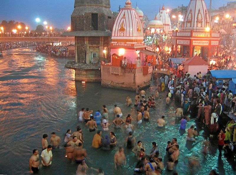
 Hemkund Sahib: A very popular trekking destination, Hemkund is a 19 km trek from Govindghat. The high altitude lake known as Hemkund (4,329 m) is located here. The lake and its picturesque surroundings are an important pilgrim center for both Hindus and Sikhs. Close to the lake, the sacred Sikh Gurudwara and a Lakshman temple are located.
Joshimath: One of the popular pilgrim centres in Uttrakhand, Joshimath was established by Adi Shankaracharya in the 8th century. There are the temples of Nav Durga and Narsingh here. This scenic town is also the base for trekking to the Valley of Flowers.
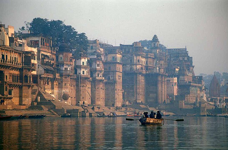
Badrinath: Badrinath, one of the holy places for Hindus in India. It is the most sacred Dham in India. Badrinath is located in the Chamoli district of Uttranchal, at around 3,133 m high from the sea level. Badrinath temple is dedicated to Hindu god Vishnu. This temple is near to the Alaknanda River.
 How to reach: The nearest airport is in Jolly Grant, Dehradun, 295 kilometers (183 miles) away, and the nearest railway station is in Rishikesh, 276 kilometers (170 miles) away. The closest you can get to The Valley of Flowers by road is Govind Ghat. This requires around a 10 hours drive to Joshimath, then another one hour to Gobindghat. From Gobindghat it is a 13-kilometers (8 miles) trek along a steep, narrow, but well defined mountain trail to base camp at Ghangaria. This will take between 4 and 8 hours, depending on your fitness. Ghangaria has Hotels with Electricity and Mobile towers. From Ghangaria Another 3 km Trek Leads to Valley.
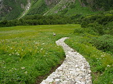
Source: http://en.wikipedia.org/wiki/Nanda_Devi_and_Valley_of_Flowers_National_Parks
Images: http://commons.wikimedia.org/wiki/Category:Valley_of_Flowers_National_Park