Saturday, August 27, 2011

Kinabalu National Park - Malaysia

Kinabalu National Park or Taman Negara Kinabalu in Malay, established as one of the first national parks of Malaysia in 1964, is Malaysia's first World Heritage Site designated by UNESCO in December 2000 for its "outstanding universal values" and the role as one of the most important biological sites in the world with more than 4,500 species of flora and fauna, including 326 bird and around 100 mammal species.

Located on the west coast of Sabah, east Malaysia on the island of Borneo; it covers an area of 754 square kilometers surrounding Mount Kinabalu, which at 4,095.2 metres, is the highest mountain on the island of Borneo.

The park is one of the most popular tourist spots in Sabah and Malaysia in general. In 2004, more than 415,360 visitors and 43,430 climbers visited the Park. The region was designated as a national park in 1964. British colonial administrator and naturalist Hugh Low led an expedition from Tuaran to the region in 1895. He also became the first recorded man to reach the peak of Mount Kinabalu. The highest peak of the mountain was later named after him—Low's Peak.

Geography
Kinabalu Park is situated on the Crocker Range on the western coast of Sabah. It is located within the district of Ranau, within the West Coast Division. The park is not to be confused with Crocker Range National Park which is a separate park in the south.
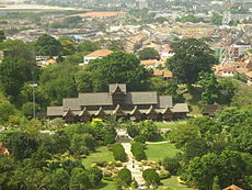
The park headquarters is 88 kilometers away from the city of Kota Kinabalu. There are highways and sealed roads leading towards the park headquarters from other parts of Sabah. It is situated on the southern boundary of Kinabalu Park, at an elevation of 1,563 m (5,128 ft).

Administration and park features
This park is administered by an organization called Sabah Parks. Accommodations in the form of chalets can be found in the park, mostly around the headquarters. Reservations for accommodation and mountain climbing guides are processed through Sutera Sanctuary Lodges (also known as Sutera Harbour), a private company. Every person who wishes to climb the mountain must be accompanied by a qualified guide. Sutera is now requiring hikers stay one night at their lodge near the entrance, in addition to a required stay at Laban Rata. The cost to stay is considerably higher than at lodging just outside the park, and includes a mandatory purchase of meals, etc.

The mountain summit trail begins at Timpohon. There is also an alternative route called the Mesilau Trail. A notable feature of the park is Low's Gully. It is a 1.6 kilometre deep ravine stretching 10 kilometres on the side of the mountain peak.

Ecology
This botanical site contains a variety of flora and fauna that ranges over 4 climate zones; from rich lowland dipterocarp forest through the montane oak, rhododendron, to the coniferous forests, to the alpine meadow plants, and to the stunted bushes of summit zone. The mountain is also known for its many carnivorous plant and orchid species, most notably Nepenthes rajah.
It is also home to a multitude of endemic animal species, including the Kinabalu Giant Red Leech and Kinabalu Giant Earthworm. The park also plays host to a variety of birds, insects, mammals, amphibians, and reptiles.

Mount Kinabalu is one of the youngest non-volcanic mountains in the world. It was formed within the last 10 to 35 million years. The mountain still grows at a rate of 5 millimetres a year. Mount Kinabalu is in Kinabalu Park in the Malaysian state of Sabah, some 80 km east of Kota Kinabalu.

Mount Kinabalu is Borneo's tallest mountain. You can climb to the top of Low's Peak (4,095.2m or 13,435.7ft above sea level). The height of the mountain is often given as 4,101m but recent satellite imaging has proven this to be incorrect.
The mountain is sacred to locals. They believe that spirits of their ancestors inhabit the top of the mountain. Previously, a chicken was sacrificed at the peak every time a climb was made but these days this ceremony only happens once a year when only seven chickens are needed to appease the spirits.

Mount Kinabalu is known to be one of the most accessible mountains in the world. No specialized mountain climbing skills are required to ascend it. The trail that most tourists use is described as a 'trek and scramble'. Locals begin climbing the mountain from the age of 3 and the oldest person to reach the peak was 80 years old. However, how much one enjoys the climb depends strongly on how fit you are and how well you acclimatize to the thin air at the higher levels.
Nevertheless, the mountain can be a dangerous place, especially during the rain or when there is mist. On average, every year one person gets into severe difficulty out of the estimated 20,000 people who attempt the climb. The higher slopes can be very slippery when it rains and dense fog reduces visibility to a few feet.

Although it is possible to climb to the top and back in less than four hours, most climbers take two days, with an overnight break at Laban Rata (3,272.7m above sea level). The final attack on the peak takes place in the early hours of the second day (most begin at 2:30AM) in order to catch the sunrise at the top. By mid-morning the mist begins to roll in, obscuring the breath-taking views.
Climbing weather is best around the month of April while November and December brings rain. The temperature ranges from a comfortable 20-25°C at the main park to something approaching freezing near the top (depending on the weather). Bring clothing appropriate or else you will get cold and be miserable. If possible, climb during the full moon as it helps illuminate the white rope that marks out the climbing path.


Sources: http://en.wikipedia.org/wiki/Kinabalu_Park
   http://wikitravel.org/en/Mount_Kinabalu
Images: http://commons.wikimedia.org/wiki/Category:Mount_Kinabalu 

George Town - Malaysia

George Town or Georgetown, is the capital of the state of Penang in Malaysia. Named after Britain's King George III, George Town is located on the north-east corner of Penang Island. The Georgetown metropolitan has a population of 1,253,748, the second largest metropolitan in Malaysia by population.
Formerly a municipality and then a city in its own right, since 1976 George Town has been part of the municipality of Penang Island, though the area formerly governed by the city council is still commonly referred to as a city, and is also known as Tanjung ("The Cape") in Malay and Qiáozhì Shì in Chinese. 
The inner city of George Town is a UNESCO World Heritage Site.

History
George Town was founded in 1786 by Captain Francis Light, a trader for the British East India Company, as base for the company in the Malay States. He obtained the island of Penang from the Sultan of Kedah and built Fort Cornwallis on the north-eastern corner of the island. The fort became the nexus of a growing trading post and the island's population reached 12,000 by 1804.
The town was built on swampy land that had to be cleared of vegetation, leveled and filled. The original commercial town was laid out between Light Street, Beach Street (then running close to the seashore), Malabar Street (subsequently called Chulia Street) and Pitt Street (now called Masjid Kapitan Keling Street).

The warehouses and go downs extended from Beach Street to the sea. By the 1880s, there were ghauts leading from Beach Street to the wharf and jetties as Beach Street receded inland due to land reclamation. A new waterfront was created at Weld Quay, where commercial buildings sprang up.
The historic commercial centre was segmented into the banking and trading areas related to port activities which included shipping companies, the import and export trade, and the wholesalers who dominate the southern section of Beach Street until now. It has been listed as a World Heritage site since July 2008.

The hub of George Town’s waterfront commercial and financial district
At the turn of the 19th century, the northern section of Beach Street and the adjacent Bishop Street were the ‘high street’ where the ‘modern’ European emporium and stores selling imported merchandise were situated.

Among the early foreign companies that located their offices on Beach Street were the Netherlands Trading Society, the Hongkong & Shanghai Banking Corporation (HSBC), the Chartered Bank, Boustead & Co., Guthne & Co., Caldbeck & Macgregor, Behn Meyer, Sandilands & Buttery, G.H. Slot and the stores of Pritchard & Co., Whiteaway, Laidlaw & Co., and others. Among the local businesses that were established here during this period were H.M. Nooradin, Tiang Lee & Co., Guan Lee Hin Steamship, Tye Sin Tat, Pinang Sales Room, Koe Guan and others. Penang’s first petroleum lamps were installed on this section of Beach Street by Huttenbach & Co..

International recognition
George Town was voted as one of the best cities in Asia by Asiaweek, ranked 6th in 1998 and 9th in 2000. More recently, George Town has improved a notch to rank as the 9th most liveable city in Asia in a survey of 254 cities worldwide according to an international location ratings survey by Employment Conditions Abroad Limited (ECA International), an agency that develops and provides solutions for the management and assignment of employees around the world, in its annual Location Ratings Survey. Previously it was ranked 10th in 2009 which saw the biggest improvement in scores among the 49 Asians cities surveyed by rising 11 notches in global best cities ranking from 74 to 63. A city is judged based on living standards according to categories, including climate, air quality, health services, housing and utilities, isolation, social network and leisure facilities, infrastructure, personal safety and political tension.

On 7 July 2008, George Town was, together with Malacca, formally inscribed as a UNESCO World Heritage Site. It is officially recognized as having a unique architectural and cultural townscape without parallel anywhere in East and Southeast Asia.

Transportation
In the past, George Town boasted of having the best public transportation system in Malaysia, with Electric Trams, Trolleybuses and also Double-decker buses. They have since been stopped in the 1970.
Today, George Town is well connected by roads, buses and etc. The Jelutong Expressway connects the city to Bayan Lepas and the Penang International Airport. With this highway, trips to the airport were cut short to 30 minutes instead of almost an hour in the past. The Penang International Airport serves as the main airport of the northern part of Malaysia.

To get over to Butterworth in the mainland, the Penang Ferry Service at Weld Quay operates every day since 1920. Passengers, cars and motorcycles can all travel in the ferry. Other than that, commuters can drive to the Penang Bridge, located in Gelugor, to cross over to the mainland. To travel elsewhere around Malaysia, through the Penang Bridge, commuters can take the North-South Expressway to reach their destinations.
Public transportation is George Town is operated mainly by Rapid Penang, the main bus company in Penang now. Almost every bus connects George Town to their respective destinations, with Weld Quay being the main terminal of Rapid Penang in Penang Island and Komtar being the main hub. There is also a free bus service operated by Rapid Penang. This bus service is only located within George Town, and it also operates every day, taking commuters a drive along George Town's famous heritage sites.

Express buses used to stop at Komtar at the past but has sinced been relocated to the Sungai Nibong Bus Terminal, which is not that far away. There are many express bus companies operating 24 hours there, and main destinations are usually Ipoh, Kuala Lumpur and Johor Bahru. There are also some buses travelling out of Malaysia, mainly to Hat Yai, Thailand and Singapore.
Other than that, George Town is famous for having trishaws plying the city. The Port of Penang has 4 ports, with 3 on the mainland and one terminal here, Swettenham Pier. The port links Penang to over 200 ports all over the world. There is also a cruise ship situated here and it has become an attraction here.

George Town features a tropical rainforest climate, under the Koppen climate classification. As is the norm for many cities with this climate, George Town experiences relatively consistent temperatures throughout the course of the year, with an average high temperature of about 31 degrees Celsius and an average low of 24 degrees Celsius. While George Town does not have a true dry season, its driest months are from December through February. The city sees on average around 2550 mm of precipitation annually.

Source, Images: http://en.wikipedia.org/wiki/George_Town,_Penang

Thursday, August 25, 2011

Malacca City - Malaysia

Malacca City is the capital city of the Malaysian state of Malacca. The Seri Negeri, the State Administrative and Development Centre which houses the Chief Minister's Office, the State Secretary's Office and the Legislative Assembly Hall are located in Malacca City. It was listed as a UNESCO World Heritage Site together with George Town of Penang on 7 July 2008.

The city of Malacca is located on both sides of the Malacca River near its mouth into the Strait of Malacca. The historic central area of the city is located near the old coastline, includes St Paul's Hill with the ruins of the Portuguese fortress, A Famosa and the Dutch Square on the right (eastern) bank of the river, and the old Chinatown on the left (western) bank. The modern city has grown in all directions from this historic core, including to the south (because the present coastline of the Strait of Malacca is somewhat farther down to the south than its original location due to land reclamation). The "Chinese Hill" (Bukit Cina), where a large old Chinese cemetery is located, was formerly located to the northeast of the town, but now is surrounded by the city on all sides. Malacca river winding its way through the old town and the city centre.

History
The site where the city of Malacca stands today was the center of Malaccan history. It was the capital of the Malacca Sultanate and was the centre of the Malay world in the 15th and the 16th century after the Malays moved over from Sumatra and was the most prosperous Entrepôt and city of the Malay Archipelago before it fell to the hand of Portuguese in 1511. Centuries of colonization by the Portuguese, Dutch and the British as well as development of Straits Chinese (Peranakan) culture have influenced the architecture of the town, notably the Portuguese A Famosa, Dutch Stadthuys, and the Dutch, Chinese and British influenced traditional town houses.
Since the founding of Singapore in 1819, Malacca has been in decline as its port was silting up and Singapore and Kuala Lumpur have grown. Over the years, many Malaccans have moved to Singapore and Kuala Lumpur, the Malaysian capital.

After World War II, anti-colonial sentiment developed amongst Malay nationalists which led to negotiations with the British and eventually the announcement of Independence by Tunku Abdul Rahman, Malaysia's first Prime Minister, at the Padang Pahlawan (Warrior's Field) at Bandar Hilir, in Melaka on 20 February 1956.
The British in Penang were temporary caretakers of the then Dutch-controlled Malacca during the Napoleonic Wars. However, they were reluctant to hand Malacca back because they feared it might jeopardize the development of their new settlement in Penang. Hence they decided to destroy the regional influence of Malacca by diverting trade away from Malacca to Penang, the British planned to destroy the Malacca Fort and its city and move the 15,000 people to Penang. It was envisaged that Malacca would not rival Penang in terms of trade when the Kew treaty of 1975 expires which orders the returning of Malacca back to Dutch hands if the city was demolished and depopulated.
The Governor of Penang ordered Captain William Farquhar to have the respective fort demolished in 1807. However during this time, Stamford Raffles who hails from Penang arrived in Malacca for his sick leave. He managed to rescind the demolition and depopulation process with the consent of Lord Minto, the Governor General of India. Raffles managed to save the archway of the Malacca Fort which can be seen to this day. The destruction of the Malacca Fort cost 70,000 sterling pounds and involved several hundred workers.

Most tourist attractions are concentrated in its small city centre which encompasses Jonker Walk which houses Malacca's traditional Chinatown that exhibits Peranakan architecture. A Famosa Fort, St. Paul Hill are among the tourist attractions located in the Bandar Hilir, old city area. There are also numerous shopping centres located nearby. The Malacca Straits Mosque is located here. There are numerous islands which include Pulau Upeh near Klebang Beach (currently undergoing reclamation works) and Pulau Besar.

Sights
European settlement
  • A Famosa fortress (Porta de Santiago) is a Portuguese fortress located in Malacca. It is among the oldest surviving European architectural remains in Asia. The Porta de Santiago, a small gate house, is the only remaining part of the fortress still standing.
  • Christ Church is an 18th century Protestant church in the city of Malacca. It is the oldest functioning Protestant church in Malaysia and is within the jurisdiction of the Lower Central Archdeaconry of the Anglican Diocese of West Malaysia.
  • The Stadthuys (Dutch administrative buildings), also known as the Red Square, is a historical structure situated in the heart of Malacca Town, the administrative capital of the state of Malacca, Malaysia. It was built by the Dutch occupants in 1650 as the office of the Dutch Governor and Deputy Governor.
  • Saint Francis Xavier Church
  • Portuguese Settlement is a Kristang community in Ujong Pasir, five km from Malacca City. The Kristang are a Malaysian ethnic group with mixed Portuguese and Malay and for some possibly Indian or Chinese ancestry, which arose during the Portuguese colonial period (16th to 17th century).
  • St. John's Fort (Kota Senjuang)
  • Ruins of St. Paul Church - Saint Francis Xavier was temporarily buried here; tombs of many Dutch dignitaries remain there. St. Paul's Church is a historic church building in Malacca that was originally built in 1521. It is located at the summit of St. Paul's Hill and is today part of the Malacca Museum Complex comprising of the A Famosa ruins, the Stadthuys and other historical buildings.
  • St. Peter Church
  • St. Theresa Church
  • Victoria Fountain
Chinese settlement
  • Bukit Cina cemetery
  • Cheng Hoon Teng temple ("Temple of Green Cloud") is a Taoist temple, located at No. 25 Jalan Tokong, Malacca Town. It is the oldest functioning temple in Malaysia. The Cheng Hoon Teng is situated close to Jalan Tukang Emas, also known as "Harmony Street" because of its proximity to the Kampung Kling Mosque and Sri Poyatha Moorthi Temple. The richly decorated Cheng Hoon Teng temple covers an area of 4,600 m2.
  • Geok Hu Keng temple
  • Poh San Teng temple
  • Jonker Street
Indian settlement
  • Sri Poyyatha temple
Malay settlement
  • Hang Jebat mausoleum
  • Hang Kasturi mausoleum
  • Kampong Morten
  • Kampung Kling mosque (sometimes also spelt Kampung Keling Mosque) is an old mosque in Malacca.
  • Tranquerah mosque
  • Malacca Straits Mosque (Malay: Masjid Selat Melaka), a modern mosque on the shore of Malacca Island, is a mosque located on the man-made Malacca Island near Malacca Town in Malacca state. It looks like a floating structure if the water level is high. Construction cost of the mosque is about MYR10 million. The Opening Ceremony was done in 24 November 2006 by the Supreme Ruler of Malaysia (Yang di-Pertuan Agong) Tuanku Syed Sirajuddin Syed Putra Jamalullail.
  • Malacca Sultanate Palace Museum is a museum located in Malacca. The building is a modern reconstruction of the palace of the sultans of Malacca. It showcases the history of the region.
Malacca’s weather is hot and humid throughout the year with rainfall, the intensity of which depends on the time of the year. Malacca features tropical rainforest climate, under the Koppen climate classification. The relatively stable weather allows Malacca to be visited all-year-round. Temperatures generally range between 30°C - 35°C during the day and 27°C - 29°C at night. It may get cooler after periods of heavy rainfall.

Generally, Malacca annual rainfall is below average of Malaysia annual rainfall. Usually, it rains in the evening after hot and humid afternoon. Malacca enjoys much sunlight during the day so it’s always warm and inviting to walk around the city. Ensure you wear light clothing, as the humidity can high and sunglasses are also quite useful.


Source: http://en.wikipedia.org/wiki/Malacca_City
Images: http://commons.wikimedia.org/wiki/Category:Melaka

Tuesday, August 2, 2011

Koh Samui - Surat Thani

Ko Samui island of Surat Thani Province (or Koh Samui, Thai: เกาะสมุย), or often, simply Samui as it is referred to by locals, is an island off the east coast of the Kra Isthmus in Thailand, close to the mainland Surat Thani town. It is Thailand's second largest island, with an area of 228.7 km2 and a population of over 50,000 (2008). It is rich with natural resources, white sandy beaches, coral reefs and coconut trees.
History
The island was probably first inhabited about 15 centuries ago, settled by fishermen from the Malay Peninsula and Southern China. It appears on Chinese maps dating back to 1687, under the name Pulo Cornam. The name Samui is mysterious in itself. Perhaps it is an extension of the name of one of the native trees, mui, or from the Malay word Saboey, meaning "safe haven". Ko is the Thai word for "island".
Until the late 20th century, Ko Samui was an isolated self-sufficient community, having little connection with the mainland of Thailand. The island was even without roads until the early 1970s, and the 15 km journey from one side of the island to the other involved a whole-day trek through the mountainous central jungles.
Ko Samui has a population of about fifty-five thousand (source: Samui Mayor's Office) and is based primarily on a successful tourist industry, as well as exports of coconut and rubber. It even has its own international airport, Samui Airport, with flights daily to Bangkok and other major airports in Southeast Asia such as Hong Kong and Singapore. Whilst the island presents an unspoiled image to the public perception, economic growth has brought not only prosperity, but changes to the island's environment and culture, a source of conflict between local residents and migrants from other parts of Thailand and other countries. Reflecting Samui's growth as a tourist destination, the Cunard ship MS Queen Victoria (a 2000-plus passenger ship) docked at Samui during its 2008 world cruise.
Ko Samui is located in the Gulf of Thailand, about 35 km northeast of Surat Thani town (9°N, 100°E). The island measures some 25 km at its widest point. It is surrounded by about sixty other islands, which compose the Ang Thong Marine National Park (Mu Ko Ang Thong National Park) and include other tourist destinations (Ko Phangan, Ko Tao and Ko Nang Yuan).
The central part of the island is an almost uninhabitable jungle mountain, Khao Pom, peaking at 635 m. The various lowland areas are connected together by a single 51 km road, running mostly along the coast to encircle the bulk of the island.
The old capital is Nathon, on the southwest coast of the island. It remains the major port for fishing and inter-island transportation. Nathon is the seat of the regional government, and the true commercial hub of the Samui locals. It has a charming pace, and is almost small enough to walk everywhere. The old Chinese shop houses along the middle street whisper of an exotic history.
Each of Samui's primary beaches is now also nominally considered as a small town, due to the number of hotels, restaurants and nightlife that have sprung up in recent years.
Ko Samui, being in Surat Thani Province, has essentially two seasons; warm and tropical most of the year, with a short rainy season. Unlike Phuket and most of the rest of Southern Thailand which has a 6-month rainy season between May and November, Samui's weather is relatively dry for the vast majority of the year, with the rainy season being primarily confined to November. For the rest of the year, since the weather is tropical, when it does rain, it usually doesn’t last long; rain showers of 20–60 minutes are typical.
Historically the island's economy has been based around subsistence agriculture and fishing, with coconuts as the main cash crop. From the 1980s onwards, tourism has become an economic factor and is now the dominant industry. The construction of a stable, high-speed internet connection in recent years has also made the island a feasible location for IT-based enterprises, which are beginning to provide a certain degree of economic diversity. The island's climate and accessibility make it particularly attractive for international investors.
Transportation
Ko Samui Airport (USM) is a private airport originally built by Bangkok Airways, which is still the main operator and was for a long time the only airline with services to Ko Samui from mainland Thailand. The airport is additionally served by Thai Airways International. Several ferries connect the island with the mainland, including the car ferry from Don Sak to a pier in the west of the island, south of the main town Nathon. Public buses to all parts of the mainland operate from a small bus station located in the south of Nathon. Songthaews (tuk-tuk style buses) circle the ring road, and private taxis are available throughout the island although these are often criticized for failure to use meters and flagrant overcharging.
Lifestyle
Although Ko Samui is in southern Thailand, where Islam has a strong influence, the original inhabitants of the island, known as 'Chao Samui', are predominantly Buddhist. In the past, most of the locals made their living in the coconut farming business. Nowadays, however, most work in jobs related to tourism.
Many locals have become wealthy from selling off land they have owned for decades. As a result of the extensive development of the island, many Thai-Chinese have come to Samui from the capital of Bangkok (Khung-Thep). Most of the manual labor needed to keep up with the island’s growth has been provided by people native to the country’s poorer north-eastern region. As a result, there is a wide cross section of economic classes on the island.
The south of Thailand is a melting pot of Buddhists, Thai Chinese, Muslims and traditional sea-faring gypsies. Ko Samui does not seem to suffer from the religious tensions in communities along the southern border of Thailand, and in general the locals live in harmony. Outside of the tourist areas, the Thai language is spoken with a thick Southern dialect which can be difficult even for northern Thais to understand.
With this broad mixture of cultures, Ko Samui is always celebrating some tradition or another, including some western ones.
Resorts & bungalows
After the exploding tourism in Ko Samui there has been a growth in building resorts, bungalows and luxury private villas on the island. This economic growth has led many businessmen from all over the world to invest in Ko Samui. With over 260 resorts and bungalows in Samui, counting from the end of year 2009, it has become Thailand's second largest resort business behind Bangkok and surpassing Phuket.
Events and festivals
Buffalo Fighting Festival One of the best-known festivals on Ko Samui is its Buffalo Fighting Festival, which is held on special occasions such as New Years Day and Songkran. Unlike Spanish bull-fighting, the fighting on Ko Samui is fairly harmless. The fighting season varies according to some ancient customs and ceremonies. The buffalo are beautifully decorated with ribbons and gold-painted leaves. Before the contest which lasts just two rounds, monks spray them with holy water. The winning owner typically takes home millions of baht in prize money.
Ten Stars Samui Art Party A recurring cultural event bringing together art lovers, local Thai and international artists and their new, original artworks. These bi-monthly events, hosted at various high-end resorts and other 5-star venues on the island, focus on building the art community on Ko Samui with presentations by featured artists.
Bowling Championship This is an annual bowling event held in May every year.
Avis Samui Tennis Open The annual amateur tennis tournament held in July.
The Fisherman's Village Festival This five-day festival is celebrated with fun, music and food. The music is usually played by well-known artists and food tents sell inexpensive cuisine provided by local hotels.
Triathlon Event The International Triathlon Union organizes this event every year. This event in Ko Samui draws more than five hundred participants from around the world. The event attracts competitors and visitors as well as locals. This event actually has never taken place and was promoted via a website only.
Samui Regatta The Samui Regatta is a sailing tournament, held every year. The tournament is internationally known and competitors come from as far away as Australia, Singapore, Japan and China. This event, for boats of all sizes and shapes, began in 2002.
Local food
In general, Southern Thai food is renowned for its spiciness. Much of the cuisine has its origins in Malay, Indonesian and Indian food. Favorite dishes from the south include Indian-style Muslim curry (massaman), rice noodles in fish curry sauce (Khanom Jeen) and chicken biryani.
Local food in Ko Samui and its province of Surat Thani are salted eggs and rambutan.
There are four international private hospitals on Samui, Samui International Hospital on the Beach Road in north Chaweng, Thai International off the Lake Road in Chaweng, Bandon Hospital on the ring road and Bangkok Samui Hospital in Chaweng Noi. The Government Hospital is in Nathon. There are also numerous clinics and pharmacies, especially at Chaweng Beach.
There are many retirees living on Ko Samui, making it a popular destination for retirement in Thailand. This is probably due to the climate, natural surroundings, and ease of living on the island.

Source: http://en.wikipedia.org/wiki/Ko_Samui
Images: http://commons.wikimedia.org/wiki/Category:Ko_Samui

Followers