Jeju-do (transliterated Korean for Jeju Province, short form of Jeju Special Autonomous Province or Cheju Island) is the only special autonomous province of South Korea, situated on and coterminous with the country's largest island. Jeju-do lies in the Korea Strait, southwest of Jeollanam-do Province, of which it was a part before it became a separate province in 1946. Its capital is the city of Jeju.
Jeju, on 1 July 2006, was made into the first and only special autonomous province of South Korea. The island contains the Natural World Heritage Site Jeju Volcanic Island and Lava Tubes.
History
According to legend, three demi-gods emerged from Samsung-hyeol which is said to have been on the northern slopes of Mt. Halla and became the progenitors of the Jeju people who founded the Kingdom of Tamna.
 It has also been claimed that three brothers including Ko-hu who were the 15th descendants of Koulla, one of the Progenitors of the Jeju people, were received by the court of Silla at which time the name Tamna was officially recognized, while the official government posts of Commander, Prince and Governor were conferred by the court upon the three.
However, there is no concrete evidence of when the "Three Names" (Samseong-Ko, Yang and Pu) appeared nor for the exact date of when Ko-hu and his brothers were received by Silla. It may be supposed that the founding Period by the "Three Names" occurred during the Three Kingdoms (Goguryeo, Baekje and Silla) period on the mainland of Korea.
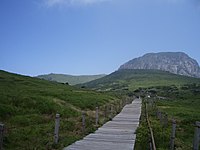
Jeju Island is a volcanic island, dominated by Halla-san (Halla Mountain): a volcano 1,950 meters high and the highest mountain in South Korea.
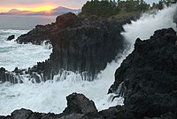
 The island was created entirely from volcanic eruptions approximately 2 million years ago, during the time period from the Tertiary to the beginning of the Quaternary period, and consists chiefly of basalt and lava. The eruptions took place in the Cenozoic era. It has a humid subtropical climate, warmer than that of the rest of Korea, with four distinct seasons. Winters are cool and dry while summers are hot, humid, and sometimes rainy. There is a crater lake which is the only crater lake in South Korea.
 An area covering about 12% (224 square kilometers) of Jeju is known as Gotjawal Forest. This area had remained untouched until the 21st century, as its base of the lava made it difficult to develop for agriculture. Because this forest remained untouched for a long time, it has a unique ecology. The forest is the main source of groundwater, the main water source for the half million people of the island, because rainwater penetrates directly into the groundwater aquifer through the cracks of the lava under the forest. Gotjawal forest is considered an internationally important wetland under the Ramsar Convention by some researchers because it is the habitat of unique species of plants and is the main source of water for the residents, although to date it has not been declared a Ramsar site.
Naming
In Korean, do is the phonetic trancription of two distinct hanja (Chinese characters) meaning "island" and "province". However, Jejudo generally refers to the island, while Jeju-do refers to the government administrative unit.
 Until 2005, Jeju Province was divided into two cities (si), Jeju and Seogwipo, and two counties (gun), Bukjeju (North Jeju) and Namjeju (South Jeju) respectively. The two cities were further divided into thirty-one neighbourhoods (dong), while the two counties were divided into seven towns (eup) and five districts (myeon). The seven towns and five districts were in turn divided into 551 villages (ri).
In 2005, Jeju residents approved, by referendum, a proposal to merge Bukjeju County into Jeju City, and Namjeju County into Seogwipo City. Effective 1 July 2006, the province was also renamed Jeju Special Autonomous Province with two nominal subdivisions, Jeju and Seogwipo city. In addition to changes in name, the province has been given extensive administrative power that has been reserved for the central government. This is part of plans to turn Jeju into a "Free International City".
Society and culture

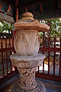
Because of the relative isolation of the island, the people of Jeju have developed a culture and language that are distinct from those of mainland Korea. Jeju is home to thousands of local legends. Perhaps the most distinct cultural artifact is the ubiquitous dol hareubang ("stone grandfather") carved from a block of basalt.
Bangsatap are small, round towers made of many stones. There are many Bangsataps and you can see them near the countryside in Jeju. People usually pile up many stones, making a shape like a tower in order to protect themselves from the bad luck in their village. They have built Bangsatap according to the theory of divination because they believe that geography is very important in choosing the right place for them. It is also a good example to demonstrate religious belief in Jeju island because it is an object that people can rely on putting rice paddle inside the Bangsatap to gather as much money as possible and also putting an iron pot to overcome a disaster and fight fire in their village. Nobody knows that when the Bangsatap was built in the past year.
 The myth of Seulmundae Halmang is well known in Jeju. According to this myth, Seulmundae Halmang (Grandmother Seulmundae) could reach from Sung San Ill Chul Bong to Guan Tal island at Aeweol in a single stride, and with both feet to Mount Halla. She was very strong, had 500 children, and built Mount Halla with seven scoops of earth.
One day, Seulmundae Halmang was making soup for her sons while her sons were out hunting. While they were gone, she fell into the pot and drowned. On their return, they hungrily ate the soup, without knowing that it contained their mother. However, the youngest son knew. He told the truth to the rest of the sons, and the whole family cried, and eventually turned into 500 stones.
Main Sights

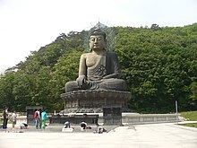
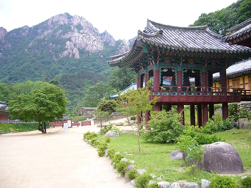
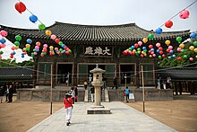
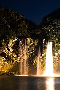
 Tourism commands a large fraction of Jeju's economy. Jeju's temperate climate, natural scenery, and beaches make it a popular tourist destination for South Koreans as well as visitors from other parts of East Asia. The most popular tourist spots on the island are Cheonjeyeon and Cheonjiyeon waterfalls, Mount Halla, Hyeobje cave, and Hyeongje island. There is a variety of leisure sports that tourists can take part in Jeju including golf, horse riding, hunting, fishing, mountain climbing, etc. Depending on the season, Jeju hosts many festivals for tourists including a penguin swimming contest in winter, cherry blossom festival in spring, the midsummer night beach festival in summer, and Jeju horse festival in autumn, among others. For most tourists, traffic to and from the island is mainly taken through Jeju International Airport and transport within the island by rental cars. Some local products are popular to tourists, including Jeju's special tile fish and mandarin oranges, aside from souvenirs and duty-free shopping.
Jeju was chosen as one of the 28 finalists of the New 7 Wonders of Nature campaign by the New7Wonders Foundation.
Tourist Attractions
Hallim Park is one of the oldest and most popular tourist attractions on Jeju. It is located on the west coast of the island.
There is an annual fire festival on the island that stems from a custom of removing harmful insects and old grass in villages every winter. The fire festival is held on the fifteenth day of the first lunar month each year. Dal-gip(to pile up much wood) is burned when the moon rises while praying for good harvests and making good wishes. Jeju traditional food is all eaten at the site of the festival. This festival was held 13 times until 2009. The Jeju Jeongwol Daeboreum Fire Festival started in 1997 and become a leading festival of Jeju. This takes place in Saebyeol Oreum located in Bongseong ri, Aewol Eup. It takes up 25 minutes from Jeju International Airport by car. Jeju citizens do their utmost to prepare the Fire Festival so as to pass down, develop and ultimately develop branding for the unique folk culture resources of Jeju. Saebyeol oreum has a characteristic of a complex volcano. It has the horseshoe shaped crater that is both very wide and slightly split. Also, it is rising high with the little peaks making oval from the south peak to northwest. The scale is above the sea level 519.3m, height 119m, circumference 2,713m, area 522,216㎡. Saebyeol oreum, which is the middle size among the 360 oreums in Jeju island. It's named after the saying "it brightens like a star".
 "Olle" is a word in the local dialect which refers to the paths between houses and public roads." "Jeju Olle" is a hiking trail founded by Suh. Myugsook. There is a narrow pathway connected from the house to an open space called "Olle". It is the jeju word and has the same sound as "Would you come?" in Korean. The first trail route was opened in September, 2007. There have been 14 opened and the trail exploration team is still working on new routes. There are many route signs. Those are blue arrows and you can fine that on the stone walls of local villages and rocks near the seaside. Blue and yellow ribbons knotted around trees lead travelers on Olle trails.
Manjanggul is one of the longest lava tubes in the world. Manjang Cave, situated at Donggimnyeong-ri, Gujwa-eup, North Jeju, 30 kilometers east of Jeju City, was designated as Natural Monument No. 98 on March 28, 1970.
 Sangumburi Crater is the crater of an extinct volcano. Unlike its brethren Halla-san and Songsan Ilch'ubong, this one exploded quickly, but did not spew much lava nor did it form much of a surrounding cone. This phenomenon is called maru in Korean, and Sangumburi is the only one of its kind in the country, making it Natural Monument #263. The remaining crater is 100 meters deep and an average of 350 meters across. Over 400 species of plants and animals live inside the crater. Visitors can walk around part of the rim (the rest is private property and fenced off), but they cannot venture down inside the crater. A well-paved path leads from the parking area to the viewing area which has a small pavilion and several vista points. Also on the grounds are numerous grave sites made in traditional Jeju fashion: a wide, trapezoidal stone wall surrounding the burial mound. Several of the sites also have small stone figures that guard the mound from evil spirits. At the park entrance are several large rocks from the crater. During the eruption, molten rock flew from the volcano into the air and cooled into many exotic shapes.
Source: http://en.wikipedia.org/wiki/Jeju-do
Images: http://commons.wikimedia.org/wiki/Category:Jeju-do