Showing posts with label Philippines. Show all posts

Monday, December 13, 2010

Banaue Rice Terraces - Philippines

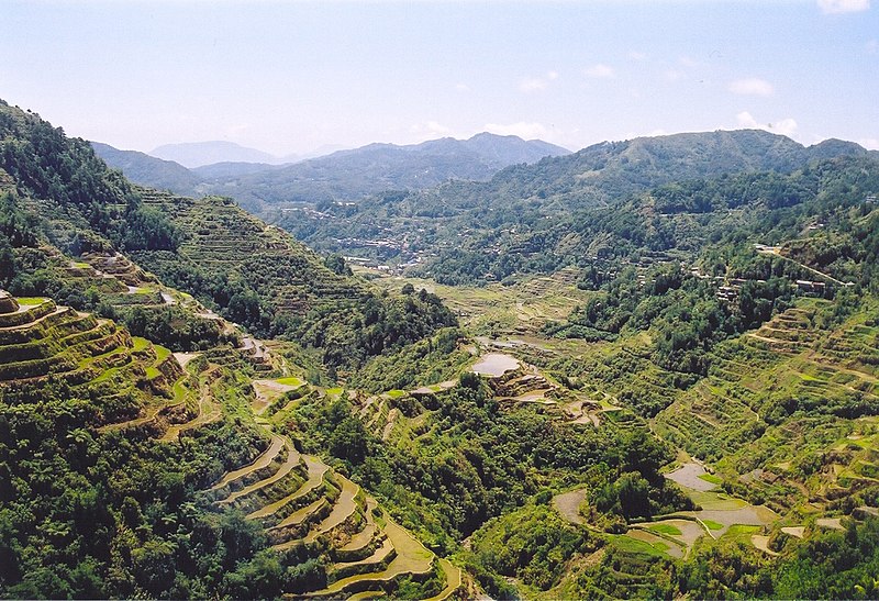
The Banaue Rice Terraces (Tagalog: Hagdan-hagdang Palayan ng Banawe) are 2000-year old terraces that were carved into the mountains of Ifugao in the Philippines by ancestors of the indigenous people. The Rice Terraces are commonly referred to by Filipinos as the "Eighth Wonder of the World". It is commonly thought that the terraces were built with minimal equipment, largely by hand. The terraces are located approximately 1500 meters (5000 ft) above sea level and cover 10,360 square kilometers (about 4000 square miles) of mountainside. They are fed by an ancient irrigation system from the rainforests above the terraces. It is said that if the steps are put end to end it would encircle half the globe.
The Banaue Terraces are part of the Rice Terraces of the Philippine Cordilleras, ancient sprawling man-made structures from 2,000 to 6,000 years old. They are found in the provinces of Kalinga, Apayao, Benguet, Mountain Province and Ifugao, and are a UNESCO World Heritage Site.
Locals to this day still plant rice and vegetables on the terraces, although more and more younger Ifugaos do not find farming appealing, often opting for the more lucrative hospitality industry generated by the Rice Terraces. The result is the gradual erosion of the characteristic "steps", which need constant reconstruction and care. In 2010 a further problem was drought, with the terraces drying up completely in March of that year.
The Banaue Rice Terraces do not have recorded data on how it was conceived in history, and that historical account involving China before the Shang Dynasty is disputable. However, historical studies and evidence have linked the terraces to the Miao tribe that thrived in China. Emperor Yu the great launched a siege to eliminate the Miao tribe who rebelled against him from 2205 to 2106 BC. The survivors of the Miao tribe fled to the south where some of them crossed the South China Sea and it is postulated that a group of these survivors reached the Cordilleras. The Miao tribe who were one of the official group minorities recognized in mainland China, they lived in cold wet mountain regions which would have made the Cordillera Mountains an easy transition from what they were used to in the mountainous southwestern region of China. Chinese features are also clearly seen in the natives of Northern Luzon. Similarly, the rituals and traditions of the Igorots and Ifugaos also show a significant resemblance to Miao culture.
The Miao are also known for cultivating terraced paddy fields and this innovation was brought to the Cordilleras, along with the influence of Tang Dynasty trading were also adapted, carabaos, fruits such as mandarin oranges, vegetables, utensils, pottery and handicraft. The Banaue Rice Terraces became prevalent with the Miao interaction with ethnic cultures of the Cordilleras before the advent and arrival of the Spanish Inquisition. This acculturation of the two cultures took on a new identity in a different environment which links us to the first records in history of the terraces.
Ifugao Rice Culture
The terraces are vastly found in the province of Ifugao and the Ifugao people have been its caretakers. Ifugao culture revolves around rice and the culture displays an elaborate array of rice culture feasts linked with agricultural rites from rice cultivation to rice consumption. Harvest season generally calls for thanksgiving feasts while the concluding harvest rites tungo or tungul (the day of rest) entail a strict taboo of any agricultural work. Partaking of the bayah (rice beer), rice cakes, and betel nut constitutes an indelible practice during the festivities and ritual activities.
The Ifugao people practice traditional farming spending most of their labor at their terraces and forest lands while occasionally tending to root crop cultivation. The Ifugaos have also been known to culture edible shells, fruit trees, and other vegetables which has been exhibited among Ifugaos for generations. The building of the rice terraces, work of blanketing walls with stones and earth which is designed to draw water from a main irrigation canal above the terrace clusters. Indigenous rice terracing technologies have been identified with the Ifugao’s rice terraces such as their knowledge of water irrigation, stonework, earthwork and terrace maintenance. As their source of life and art, the rice terraces have sustained and shaped the lives of the community members. Ifugao previously belong to the Mountain Province as a municipality but on June 18, 1966 in effect of Republic Act No. 4695, Ifugao became an independent province.
In March 2009 the Ifugao rice terraces were declared free from Genetically Modified Organism (GMO). An event was organized in Dianara Viewpoint for this announcement where it was graced by Gov. Teodoro Baguilat, Mayor Lino Madchiw, Greenpeace campaigner for Southeast Asia Daniel Ocampo, and Cathy Untalan who was executive director of the Miss Earth Foundation. Before the announcement ceremonies, 3 Mumbakis performed an Alim, a tribal ritual to ask for blessings where an animal is offered to the gods.
Another thriving economy in the Banaue Rice Terraces is tourism. The Tourism industry has developed a number of activities for visitors which may include the traditional sight seeing of the terraces and visits to the tribes at the foot of the terraces. A Mumbaki (traditional Ifugao witch doctor) is also recommended to visitors, these doctors can perform spiritual healing rituals. Domestic tourism however has gone down over the past few years. A contributing factor to this is the treatment of Domestic tourists by the local guides in the area where it has been reported that local guides are more willing to entertain foreign visitors. The Batad Environmental Tour Guides Association (BETGA) in association with the Batad Baranguay authorities are currently laying a concrete track down from the Batad Saddle to the village proper.
Preservation
The Banaue Rice Terraces of the Philippine Cordilleras was named as a world heritage site by the UNESCO World Heritage Centre in 1995. It has passed by UNESCO’s standards due to the blending of the physical, socio-cultural, economic, religious, and political environment as a living cultural landscape. It has passed UNESCO's 3 criteria:
  • Criterion (iii) - The terraces have been used as the community’s sustainable and primarily communal system of rice production.
  • Criterion (iv) - The rice terraces are a memorial to the history and labor of unrecorded generations which may span several thousand generations.
  • Criterion (v) - The rice terraces are a good example of land use as a result of the interaction between the community and the environment.
The Banaue Rice Terraces have also been in-scripted to the List of World Heritage in Danger on 2001 as the dangers of deforestation and climate change threatens to destroy the terraces. Another contributing factor is globalization where the younger generations of the Ifugaos have recently had the opportunity to gain access to media and education, most of the younger Ifugaos have opted to come to the capital for work instead of the traditional farming tradition.
Aside from the terraces, the UNESCO World Heritage List has proclaimed the Ifugao epic Hudhud as among the one of the world’s intangible heritages in 2001. The Hudhud consists of narrative chants performed mainly by elder Ifugao women usually during the rice sowing season, at harvest time and at funeral wakes and rituals.
Other notable rice terraces in Ifugao
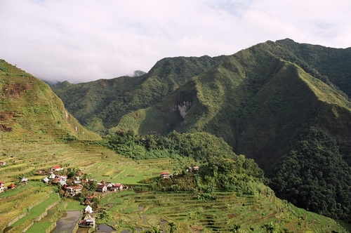
Aside from the Banaue Rice terraces there are 4 other similar terraces, the Batad rice terraces, Mayoyao rice terraces, Hapao rice terraces and Kiangan rice terraces. The Batad rice terraces are located in Barangay Batad in Banaue, these terraces shaped resembles an amphitheatre. The Mayoyao rice terraces are for a rice variety called tinawon, a rare type of organic rice which are grown in red and white variety in these terraces. The Hapao rice terraces are located in Hungduan, these terraces are stone-walled and date back to 650 AD. The Kiangan rice terraces is similarly located in Banaue, here they grow the rice varieties of nagacadan and julungan.


Source: http://en.wikipedia.org/wiki/Banaue_Rice_Terraces
Images: http://commons.wikimedia.org/wiki/Category:Banaue_rice_terraces

Monday, November 15, 2010

Mayon Volcano - Philippines

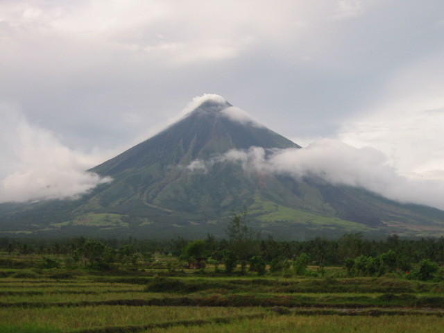
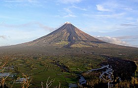
Mayon Volcano, also known as Mount Mayon, is an active stratovolcano in the province of Albay, in the Bicol Region, on the island of Luzon, in the Philippines.
Renowned as the "perfect cone" because of its almost symmetrically conical shape, Mayon forms the northern boundary of Legazpi City. Local folklore refers to the volcano as Bulkang Magayon (Filipino: 'Magayon Volcano'), after the legendary heroine Daragang Magayon (Bikol: 'Lady Beautiful').
On October 13, 2008 it was included in New 7 Wonders of Nature Top 10 list. However, it did not make the cut to the Top 25 finalists, giving way to the Puerto Princesa Subterranean River, another site in the Philippines.
Mayon Volcano is an active stratovolcano. The current cone was formed through pyroclastic and lava flows from past eruptions. Mayon is the most active of the active volcanoes in the Philippines, having erupted over 49 times in the past 400 years.
It is located on the eastern side of Luzon, beside the Philippine Trench which is the convergent boundary where the Philippine Sea Plate is driven under the Philippine Mobile Belt. Where a continental plate or belt of continental fragments meets an oceanic plate, the lighter continental material overrides the oceanic plate, forcing it down into the Earth's mantle. Magma may be forced through weaknesses in the continental crust caused by the collision of the tectonic plates. One such exit point is Mayon. Like other volcanoes located around the rim of the Pacific Ocean, Mayon is part of the Pacific Ring of Fire.
Mayon Volcano is the main landmark of Albay Province, Philippines. It is 10 kilometres (6 mi) from the Gulf of Albay, in the cities and municipalities of Legazpi City, Daraga, Camalig, Guinobatan, Ligao City, Tabaco City, Malilipot, and Santo Domingo (clockwise from Legazpi). It rises 2462 m (8,077 ft) above the gulf.
Mayon Volcano is the Philippines’ most active volcano and is considered to be the world's most perfectly formed volcano for its symmetrical cone. It is a basaltic-andesitic volcano. The upper slopes of the volcano are steep averaging 35-40 degrees and are capped by a small summit crater. Its sides are layers of lava and other volcanic material.
Mayon has undergone forty-nine eruptions in recorded history. The first recorded major eruption was in 1616. Its 48th and latest major eruption was a quiet effusion of lava on July 14, 2008, which was aggravated when a lahar caused by the rains of Typhoon Durian followed on November 30, 2006. A further summit eruption occurred on August 10, 2008. At present the volcano is weakly erupting and may be building up to a larger hazardous eruption.
The most destructive eruption of Mayon occurred on February 1, 1814. Lava flowed but not as much compared to the 1766 eruption. Instead, the volcano was belching dark ash and eventually bombarding the town with tephra that buried the town of Cagsawa—only the bell tower of the town's church remained above the new surface. Trees were burned; rivers were certainly damaged. Proximate areas were also devastated by the eruption with ash accumulating to 9 m (30 ft) in depth. 2,200 Albay locals perished in what is considered to be the most lethal eruption in Mayon's history.
Mayon Volcano is the most active volcano in the Philippines, and its activity is regularly monitored by PHIVOLCS from their provincial headquarters on Lignon Hill, about 10 kilometers away from the summit. Three telemetric units are installed on Mayon's slopes, which send information to the seven seismometers in different locations around the volcano. These instruments relay data to the Lignon Hill observatory and the PHIVOLCS central headquarters on the University of the Philippines Diliman campus. PHIVOLCS also deploys electronic distance meters (EDMs), precise leveling benchmarks, and portable fly spectrometers to monitor the volcano's daily activity.


Source: http://en.wikipedia.org/wiki/Mayon_Volcano
Images: http://commons.wikimedia.org/wiki/Mayon_Volcano

Wednesday, November 10, 2010

Puerto Princesa Underground River - Philippines

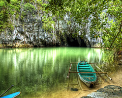
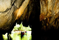
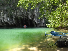
The Puerto Princesa Subterranean River National Park is located about 50 kilometers north of the city of Puerto Princesa, Palawan, Philippines. The National Park is located in the Saint Paul Mountain Range on the northern coast of the island. It is bordered by St. Paul Bay to the north and the Babuyan River to the east. The City Government of Puerto Princesa has managed the National Park since 1992. It is also known as St. Paul's Subterranean River National Park, or St. Paul Underground River. The entrance to the Subterranean River is a short hike from the town of Sabang. Puerto Princesa Subterranean River National Park is one of the 28 finalists for the "New Seven Wonders of Nature" competition.
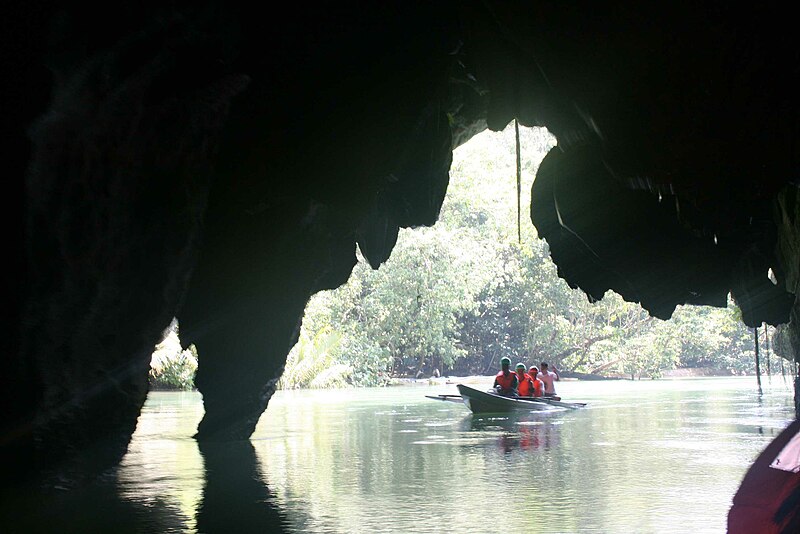
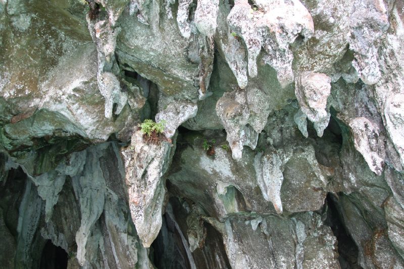
The park has a limestone karst mountain landscape with an 8.2 kilometer navigable underground river. A distinguishing feature of the river is that it winds through a cave before flowing directly into the South China Sea. It includes major formations of stalactites and stalagmites, and several large chambers. The lower portion of the river is subject to tidal influences. Until the 2007 discovery of an underground river in Mexico's Yucatan Peninsula, the Puerto Princesa Subterranean River was reputed to be the world's longest underground river.
The area also represents a habitat for biodiversity conservation. The site contains a full mountain-to-the-sea ecosystem and has some of the most important forests in Asia. It was inscribed by UNESCO as a World Heritage Site on December 4, 1999.
The Park has a range of forest formations representing eight of the thirteen forest types found in tropical Asia, namely forest over ultramafic soils, forest over limestone soils, montane forest, freshwater swamp forest, lowland evergreen tropical rainforest, riverine forest, beach forest, and mangrove forest. Researchers have identified more than 800 plant species from 300 genera and 100 families. These include at least 295 trees dominated by the dipterocarp type of species. In the lowland forest, large trees such as the Dao (Dracontomelon dao), Ipil (Intsia bijuga), Dita (Alstonia scholaris), Amugis (Koordersiodendrum pinnatum), and Apitong (Dipterocarpus gracilis) are common. Beach forest species include Bitaog (Calophyllum inophyllum), Pongamia pinnata, and Erynthia orientalis. Other notable plant species include Almaciga (Agathis philippinensis), Kamagong (Diospyros pulganensis) Pandan (Pandanus sp.) Anibong, and Rattan (Calamus sp.).
Birds comprise the largest group of vertebrates found in the Park. Of the 252 bird species known to occur in Palawan, a total of 165 species of birds were recorded in the park. This represents 67% of the total birds and all of the 15 endemic bird species of Palawan. Notable species seen in the park are the Blue-naped parrot (Tanygnathus lucionensis), Tabon scrub fowl (Megapodius cumunigii), Hill myna (Gracula religiosa), Palawan hornbill (Anthracoceros marchei), White breasted sea eagle (Halitutus leucogates).
There are also some 30 mammal species that have been recorded (Madulid, 1998). Most often observed in the forest canopy and along the shoreline feeding during low tide is the long-tailed macaque (Macaca fascicularis), the only primate found in the area. Other mammal species in the Park are the Bearded pig (Sus barbatus), Bearcat (Arctictis binturong), Palawan stink badger (Mydaus marchei) and the Palawan porcupine (Hystrix pumilus).
19 species of reptiles have been identified, eight of which are endemic (Madulid, 1998). Common species in the area include large predators like the Common reticulated python (Phython reticulatus), the Monitor lizard (Varanus salvator) and the green crested lizard (Bronchocoela cristatella). Amphibian fauna include ten species. The Philippine woodland frog (Rana acanthi) is the most dominant and frequently encountered. One species, Barbourula busuangensis, endemic to Palawan was also observed in the area.
Notable are the nine species of bats, two species of swiftlets and whip spider (Stygophrynus sp.) found in the cave, and the Sea cow (Dugong dugon) and the Hawksbill sea turtle (Chelonia mydas) that feed in the coastal area of the Park.

Source, Images: 
  http://en.wikipedia.org/wiki/Puerto_Princesa_Subterranean_River_National_Park
Some images: http://www.flickr.com/photos/

Friday, November 5, 2010

Chocolate Hills - Philippines

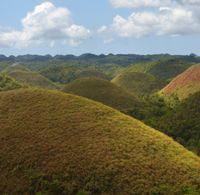
The Chocolate Hills are an unusual geological formation in Bohol, Philippines. According to the latest accurate survey done, there are 1,776 hills spread over an area of more than 50 square kilometres (20 sq mi). They are covered in green grass that turns brown during the dry season, hence the name.
The Chocolate Hills are a famous tourist attraction of Bohol. They are featured in the provincial flag and seal to symbolize the abundance of natural attractions in the province. They are in the Philippine Tourism Authority's list of tourist destinations in the Philippines; they have been declared the country's 3rd National Geological Monument and proposed for inclusion in the UNESCO World Heritage List.
The Chocolate Hills is a rolling terrain of haycock hills – mounds of general shape which are conical and almost symmetrical. Estimated to be at least 1,268 individual mounds to about 1,776, these cone-shaped or dome-shaped hills are actually made of grass-covered limestone. The domes vary in sizes from 30 to 50 metres (98 to 160 ft) high with the largest being 120 metres (390 ft) in height. They are scattered throughout the towns of Carmen, Batuan and Sagbayan in Bohol. Bohol's "main attraction", these unique mound-shaped hills are scattered by the hundreds on the island's central plain, concentrated near the town of Carmen.
During the dry season, the precipitation is inadequate such that the grass-covered hills dry up and turn chocolate brown. This transforms the area into seemingly endless rows of "chocolate kisses". The branded confection is the inspiration behind the name, Chocolate Hills.
The Chocolate Hills consist of conical karst hills, called mogote, created by a combination of the dissolution of limestones by rainfall, surface water, and groundwater and their subaerial erosion by rivers and streams after they had been uplifted above sea level and fractured by tectonic processes. These hills are separated by well developed flat plains and contain numerous caves and springs. The Chocolate Hills are considered to be a remarkable example of conical karst topography.
The origin for the conical karst of the Chocolate Hills is described in popular terms on the bronze plaque at the viewing deck in Carmen, Bohol. This plaque states that they are eroded formations of a type of marine limestone that sits on top of hardened clay. The plaque reads:  The unique land form known as the Chocolate Hills of Bohol was formed ages ago by the uplift of coral deposits and the action of rain water and erosion.
The plaque also makes reference to a fanciful explanation of the origin of the Chocolate Hills that is unsupported by any published scientific research, i.e. either Hillmer or Travaglia and other, when it states:  the grassy hills were once coral reefs that erupted from the sea in a massive geologic shift. Wind and water put on the finishing touches over hundreds of thousands of years.
Self-published, popular web pages present a variety of fanciful and less credible explanations about how these hills formed. They include sub-oceanic volcanism; limestone covered blocks created by the destruction of an active volcano in a cataclysmic eruption; coral reefs that were raised form the from the sea as the result of a massive geologic shift; and tidal movements. The lack of any exposed or associated volcanic rocks anywhere in the Chocolate Hills refutes the popular theories involving volcanic eruptions. These theories involving either a sudden, massive geologic shift, coral reefs being erupted from the sea, or tidal movements lack any collaborating evidence and support among geologists.
The Chocolate Hills placed Bohol on the tourist map long before the beautiful white beaches of the island became major tourist destinations. The most famous and signature tourist attraction of Bohol, it is a prime tourist destination in the Philippines. This is because the Chocolate Hills are incomparable and is one of the country's most spectacular sceneries. Philippine President Gloria Macapagal-Arroyo, who admits that she is the No. 1 tourist of Bohol for having visited the province so many times, said: "Bohol is a major tourist province. The fame of the Chocolate Hills is not only known in the country but worldwide.” The national government has chosen the Chocolate Hills as one of its "flagship tourist destinations".


Source: http://en.wikipedia.org/wiki/Chocolate_Hills
Images: http://commons.wikimedia.org/wiki/Category:Chocolate_Hills

Wednesday, November 3, 2010

Tubbataha Reef - Philippines

Whitetip reef shark at Tubbataha
Tubbataha Reef is an atoll coral reef located in the Sulu Sea of the Philippines. It is a marine sanctuary protected as Tubbataha Reef National Marine Park. It is nominated at the New 7 Wonders of Nature. The word tubbataha is a combination of two Samal words: tubba and taha, which together means "a long reef exposed at low tide".
Tubbataha is located in the Sulu Sea, 98 nautical miles (181 km) southeast of Puerto Princesa City in the Palawan Province. The reef is made up of two coral atolls divided by an eight-kilometer (5 miles) wide channel. The South Atoll, the smaller of the two is five kilometers in length and three kilometers in width; while the North Atoll, the larger of the two is 16 kilometers (10 miles) long and five kilometers (3 miles) wide. Each reef has a single small islet that protrudes from the water. The atolls are separated by a deep channel 8 km (5 miles) wide.
There are no permanent inhabitants of the islets or reefs. Fishermen visit the area seasonally, establishing shelters on the islets. The park is visited by tourists, particularly divers. Trips to Tubbattaha from mid-March to mid-June are all vessel-based; the park is about twelve hours by boat from Puerto Princesa City. Tubbataha is considered as the best dive site in the Philippines and the diving dedicated ships that operate during the "Tubbataha Season" are usually booked years in advance especially during the Asian holidays of Easter and "Golden Week".
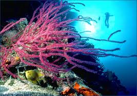
Tubbataha has become a popular site for seasoned sports divers because of its coral "walls" where the shallow coral reef abruptly ends giving way to great depths. These "walls" are not only wonderful diving spots but they are also wonderful habitats for many colonies of fish. There are giant jacks, hammerhead sharks, barracudas, manta rays, palm-sized Moorish idols, [parrot fishes], and moray eels living in the sanctuary. Tubbataha is even home to the hawksbill sea turtles (Eretmochely imbricata) which are endangered species.
Over 1000 species inhabit in the reef; many are already considered as endangered. Animal species found include manta rays, lionfish, tortoise, clownfish, and sharks. Vivid corals cover more than two-thirds of the area and the waters around the reef are places of refuge for numerous marine lives. The seemingly diverse ecosystem of this sanctuary rivals the Great Barrier Reef – having 350 coral species and 500 fish species. In June 2009 an outbreak of the crown-of-thorns starfish was observed, possibly affecting the ecological functioning of this relatively pristine coral reef.

Aside from being a marine sanctuary, Tubbataha is also renowned for being a bird sanctuary. A lighthouse islet, at the southern tip of the South Atoll, supports a large number of seabirds which nest there. Around the Tubbataha, there are tens of thousands of masked red-foot boobies, terns, and frigate birds resting during their annual migrations. To minimize any external intrusions, the Philippine Coast Guard maintains a small monitoring station on one of the many permanent sand bars.

The Tubbataha National Marine Park, located at the Central Sulu Sea, is a marine sanctuary containing a reef of enormous size. It was established in August 11, 1988 with an area of 332 km² (82,000 acres). In 2006, President Gloria Macapagal Arroyo, through an Executive Order, increased the boundaries of the park by 200%. It is now 968.24 km² (239,000 acres) in size and is guarded by armed rangers 24 hours/ 7 days a week.

Declared a World Heritage Site by the United Nations Educational, Scientific, and Cultural Organization (UNESCO) in December 1993, it is under protective management by the Philippines Department of National Defense (DND). It is under technical supervision by the Palawan Council for Sustainable Development (PCSD) & the Department of Environment & Natural Resources (DENR). It is administered as part of Cagayancillo town on Palawan. It is also nominated in the new 7 wonders of nature.


Source, Images: http://en.wikipedia.org/wiki/Tubbataha_Reef

Followers